Summary
- Where: General Hospital area
- When: 14 June 2019 for 21 days (Consultation has ended)
- What: General Hospital area Residential Parking Formal Consultation
Latest News
This consultation on these proposed changes was concluded in July 2019 and a decision on the implementation was due to be announced in 2020 but has been postponed due to the current COVID 19 pandemic. This page contains details of the proposals set out during the 2019 consultation.
Details
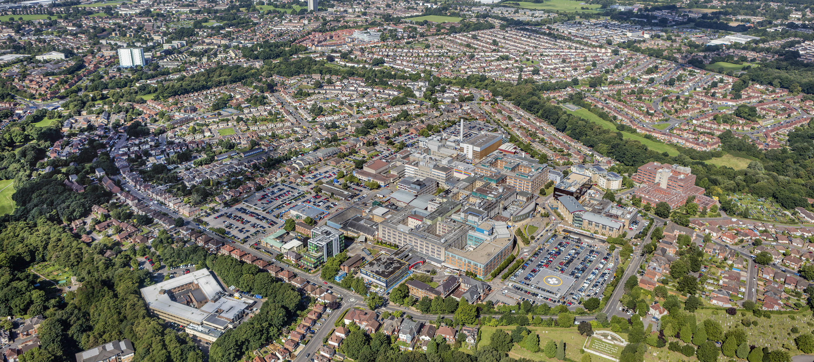
Southampton General Hospital employs over 10,550 staff, many of whom travel to the site from across a wide area. Although the General Hospital provides parking and park & ride facilities, together with promoting travel by bus or cycle, some staff continue to commute by car and park in residential areas beyond the existing Residents Parking Zone 7. Residents raised the issues caused by staff and periodic visitor parking in their roads with Ward Councillors and in response a consultation event was held at the General Hospital in November 2017 attended by around 300 people.
In the response to community concerns, a survey was then undertaken in 2018 of residents in localities agreed with Ward Councillors, to see whether they would support permit parking schemes where they live. Where the survey responses indicated community support, permit parking schemes are now being proposed. The formal 21-day public consultation will commence on 14 June 2019.
The schemes would introduce parking restrictions in the following localities:
- West of Warren Crescent (Zone 7 extension) locality: (Bindon Close, Bindon Road, Coxford Close, Ross Gardens, Warren Close, and Warren Crescent (36-66).
- Dunkirk Road/Coxford Road locality: (Arnheim Close, Arnheim Road, Dunkirk Close, Dunkirk Road, Falaise Close, Salerno Road and Taranto Road).
- Hollybrook locality: (Hunton Close, Linford Crescent, Malvern Road, Malwood Avenue, Seagarth Close, Seagarth Lane (from 21 Seagarth Lane northwards), Seymour Close and Seymour Road.
- St James Park & Wilton Road locality: (Queens Road, Wilton Road (2-92 & 1-107), St. James Close, Bellemoor Road, Church Street (133-161 & 132-142), Morland Road, Shayer Road, St. James’s Road (as far south as Salem Street) and Twyford Avenue.
- Maybush, Coxford & Aldermoor locality: (Alder Road (1-37, 2-26), Aldermoor Avenue, Aldermoor Road, Brightside Road, Conifer Road, Coxford Drove, Hardwicke Close, Holly Oak Court, Holly Oak Road, Larch Road, Linden Road, Myrtle Road, Olive Road, Outer Circle, Palm Road, Peach Road, Rowan Close, Thorndike Close and Thorndike Road). (Please note that if a scheme proceeds in this locality (including Olive Road), it is also proposed to change the zone for the permit parking restrictions outside 26-38 and 27-48 Olive Road to the new zone).
Housing car parks within these localities are also included in the proposed permit parking schemes.
Copies of the draft order, statement of reasons and related public notices for all the schemes can be viewed on the public notices and documents page.
Alternatively, they may be inspected during normal working hours at Civic Centre, Southampton, SO14 7LY. The public notices will also be posted in the streets affected.
Any person wishing to object to the Order must write to the Highways Legal Team at Southampton City Council, Civic Centre, Southampton, SO14 7LY or email Traffic.Orders.Legal@southampton.gov.uk quoting the Order Title (and scheme locality) you are objecting to and stating the grounds for objection by 5t July 2019.
The responses to the consultation will then be considered collectively, in discussion with Ward Councillors, before the Council decides upon them.
Residents and any other interested parties can stay in touch with the project by registering to Stay Connected.